2026-02-04
The Amazon Basin, home to the largest rainforest on Earth, shelters one of the most diverse ecosystems in the world. More than 10% of known plant and animal species live and thrive here, woven into a delicate balance of life. For generations, the guardians of this vast forest have been Indigenous Peoples, whose knowledge, care, and stewardship have preserved this forest. Their territories today not only show lower rates of deforestation but also safeguard one of the planet’s last great carbon sinks. This is an undeniable testament of their role as protectors.
Yet these territories remain under constant threat. Mining projects, petroleum concessions, land encroachment, expanding agricultural frontiers, and the presence of armed groups push relentlessly against their boundaries
Today, in a world moved by fast-paced technology, Indigenous Peoples in the Amazon are developing and leveraging Indigenous geographic information systems (GIS) as tools to protect their lands. Using coordinates, digital maps, and satellite images, they are advancing territorial defence and Indigenous autonomy—continuing their centuries-long legacy of resistance.
Colombia offers a powerful example of how Indigenous GIS are reshaping territorial defence.
The SIG Indígena (Indigenous GIS)—developed by Tenure Facility partner the National Commission of Indigenous Territories (CNTI) in partnership with the Agustín Codazzi Geographic Institute (IGAC), the Colombian government agency responsible for producing the official map and the basic cartography of Colombia—compiles nationwide geographic and Indigenous data in a single platform. Tenure Facility has provided funding for the tool’s continued development.
Launched seven years ago, the tool moved from being a dream to being operationalised. Since then, it has undergone continuous development. Today, it integrates dozens of layers of information, including Indigenous reserves (resguardos) and land claims, key biodiversity areas and protected areas, and geographic data from across the country. Alongside the tool’s increasing technical sophistication, the collaboration between CNTI and IGAC has also evolved. While the relationship was not always seamless, it has strengthened over time into a trusted partnership with clearly defined roles: CNTI produces, manages, and owns the data, and IGAC is responsible for managing and continuously improving the tool.
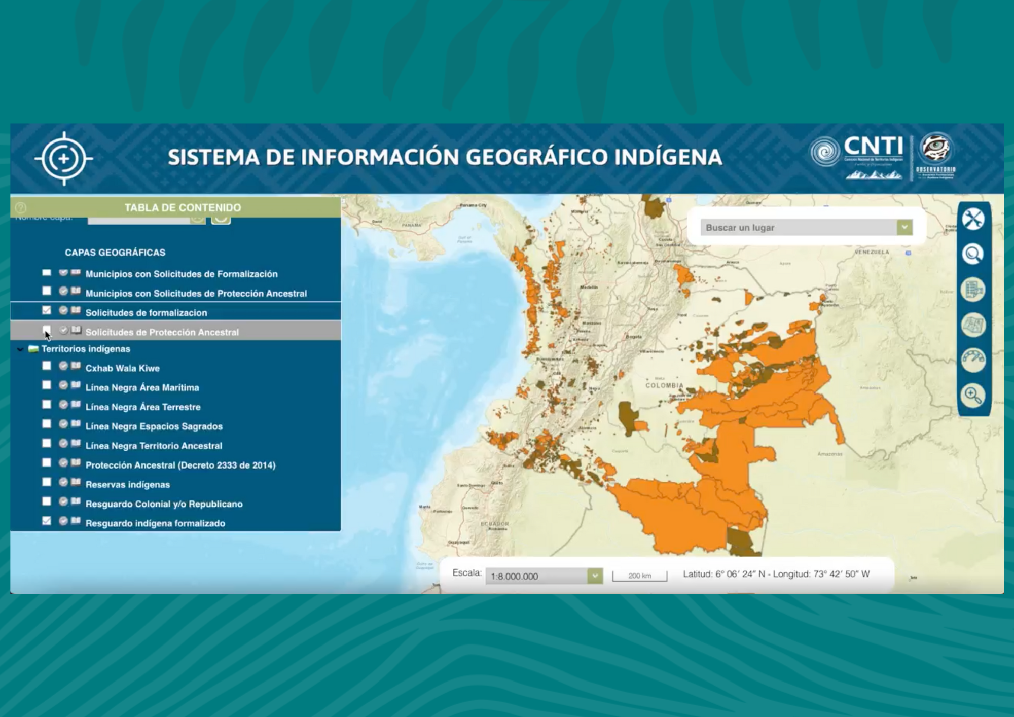
Screengrab SIG Indígena
Besides its multiple functions—this unique tool brings together public geographic data with data produced, managed, and owned by Indigenous Peoples.
As Camilo Niño, CNTI’s technical secretary, noted, “At one point in history, no one could say how many Indigenous reserves there were in Colombia because different government entities had different information. And we, Indigenous Peoples, also had different information. Today, with our system, we can say with certainty that there are 946 established reserves in Colombia.”
For many years, the Colombian government lacked consolidated geographic information on Indigenous territories. The National Land Agency had certain numbers, while the Ministry of the Interior, the National Planning Department, and the National Administrative Department of Statistics had others. And in the meantime, Indigenous territories were facing increasing external pressures such as mining concessions, agro-industrial expansion, and infrastructure development—affecting their ancestral lands and forests, including sacred sites.
“In Putumayo [a department in southwest Colombia],” shared Niño, “the national government titled Indigenous reserves but issued concessions for oil exploration at the same time. Our system allowed us to see this overlap. It gave us information to demand the effective fulfilment of our territorial rights.”
The SIG Indígena is thus transformative, it connects two sources of information that historically existed in silos, allowing for data-driven coordination and decision-making. The SIG Indígena is much more than a technical tool, it is a political tool that allows Indigenous Peoples in Colombia to make decisions related to territorial management, identify territorial conflicts, and use evidence to assert their land rights.
"Our system...gave us information to demand the effective fulfilment of our territorial rights.” "
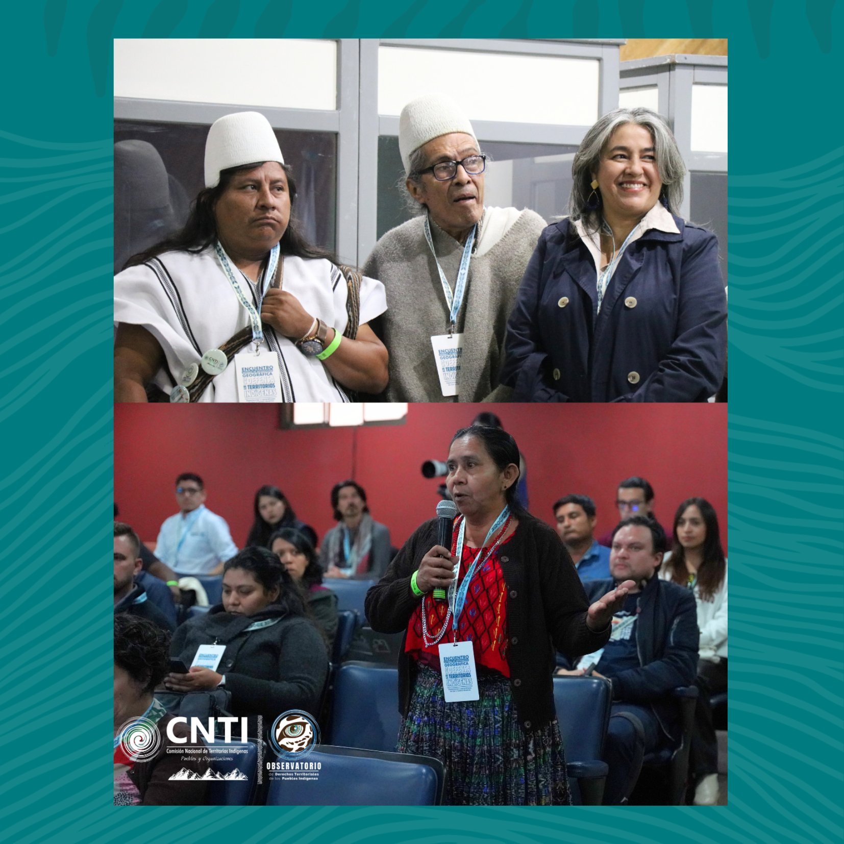
Participants of the GIS learning exchange in Bogota
The strength of Indigenous GIS lies not only in technology itself but also in the principles guiding the systems’ creation.
At a learning exchange in September 2025 in Bogotá, “Geographic Information Systems for the Defence of Indigenous Territories: Experiences and Learnings from South and Central America,” Indigenous organisations gathered to share practices and lessons learned. The event was organised by CNTI, with support from TINTA and Tenure Facility.
During this event CNTI and IGAC identified three key pillars for their tool’s success:
Trust and collaboration between CNTI and IGAC was vital in the case of Colombia. Creating a joint GIS underscored Indigenous communities’ vital role in producing and managing data about their territories, while ensuring credibility as a government-validated tool with public geographic data.
As one IGAC official reflected, “We spent almost three years trying to reach agreements between CNTI and IGAC [to develop the SIG Indígena], in meetings where we often made little progress. But during that time, we built real relationships of trust, which allowed the project to move forward.”
Although trusted and resilient relationships with government authorities were a cornerstone for the success of the SIG Indígena in Colombia, they remain difficult for Indigenous organisations in other country contexts to establish. Building and maintaining these relationships requires mutual understanding, political will, resources, and time—all factors that are sometimes scarce.
The information contained in Indigenous GIS tools is powerful but also sensitive. Mishandling could endanger entire communities. Misused or filtered data could propel persecution of Indigenous defenders or supply information that fuels illegal economies in Indigenous lands.
For this reason, Indigenous Peoples must retain full ownership and control over how their data is collected, stored, and shared. Maps and analyses must serve the communities first, strengthening—not compromising—their sovereignty.
Developing and maintaining an Indigenous GIS is resource-intensive and technically complex. Effective systems require ongoing technical support, management, and strategic planning. Ensuring their sustainability goes beyond server maintenance or routine updates to encompass broader administrative, political, legal, and financial considerations.
Equally essential is the understanding that defending Indigenous territories goes far beyond drawing lines on a map. It requires protecting education, health, spirituality, and culture; territories need to be managed, monitored, and protected based on long-term holistic planning and with reliable financial support.
"We spent almost three years trying to reach agreements between CNTI and IGAC [to develop the SIG Indígena], in meetings where we often made little progress. But during that time, we built real relationships of trust, which allowed the project to move forward."
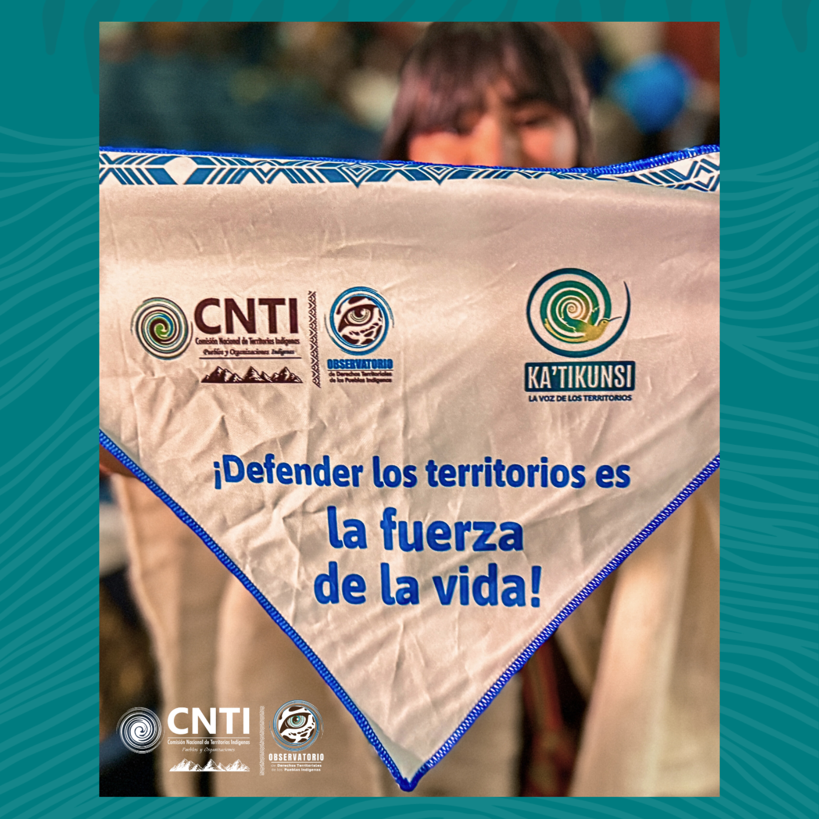
CNTI's slogan - defending territories means to defend life itself. Photo credit: CNTI
Colombia’s experience—although unique—is not an isolated case. Across Latin America, Indigenous organisations are leveraging GIS to protect and monitor their territories. Various Tenure Facility partner organisations shared their experiences during the GIS learning exchange in Bogotá.
In Peru, the Native Federation of the Madre de Dios River and Tributaries (FENAMAD) uses community mapping to protect the territorial rights of Indigenous communities and Indigenous Peoples in voluntary isolation in the Amazon. Using ForestLink, a mobile app that works in remote areas, communities collect field-based information and report threats to their territories in real time, enabling rapid documentation and response to risks on the ground.
For example, in 2025, FENAMAD’s Forest Oversight Committee updated its map of Native communities, identifying the main threats affecting their territories, including mining, logging, road construction, illicit crops, and poaching. They marked overlaps between mining concessions and areas requested for formalisation by Indigenous communities.
In Guyana, the Amerindian Peoples Association (APA) has used geospatial maps to identify mining concessions overlapping with Indigenous territories—leveraging this evidence in dialogue with the government to secure their removal.
In Ecuador, the Confederation of Indigenous Nationalities of the Ecuadorian Amazon (CONFENIAE) combines information systems with community-based territorial monitoring teams. These local guardians trained to track deforestation, illegal mining, and petroleum concessions are helping protect the rainforest and lives.
Through technology and innovation, Indigenous Peoples are reclaiming power and control over their territories.
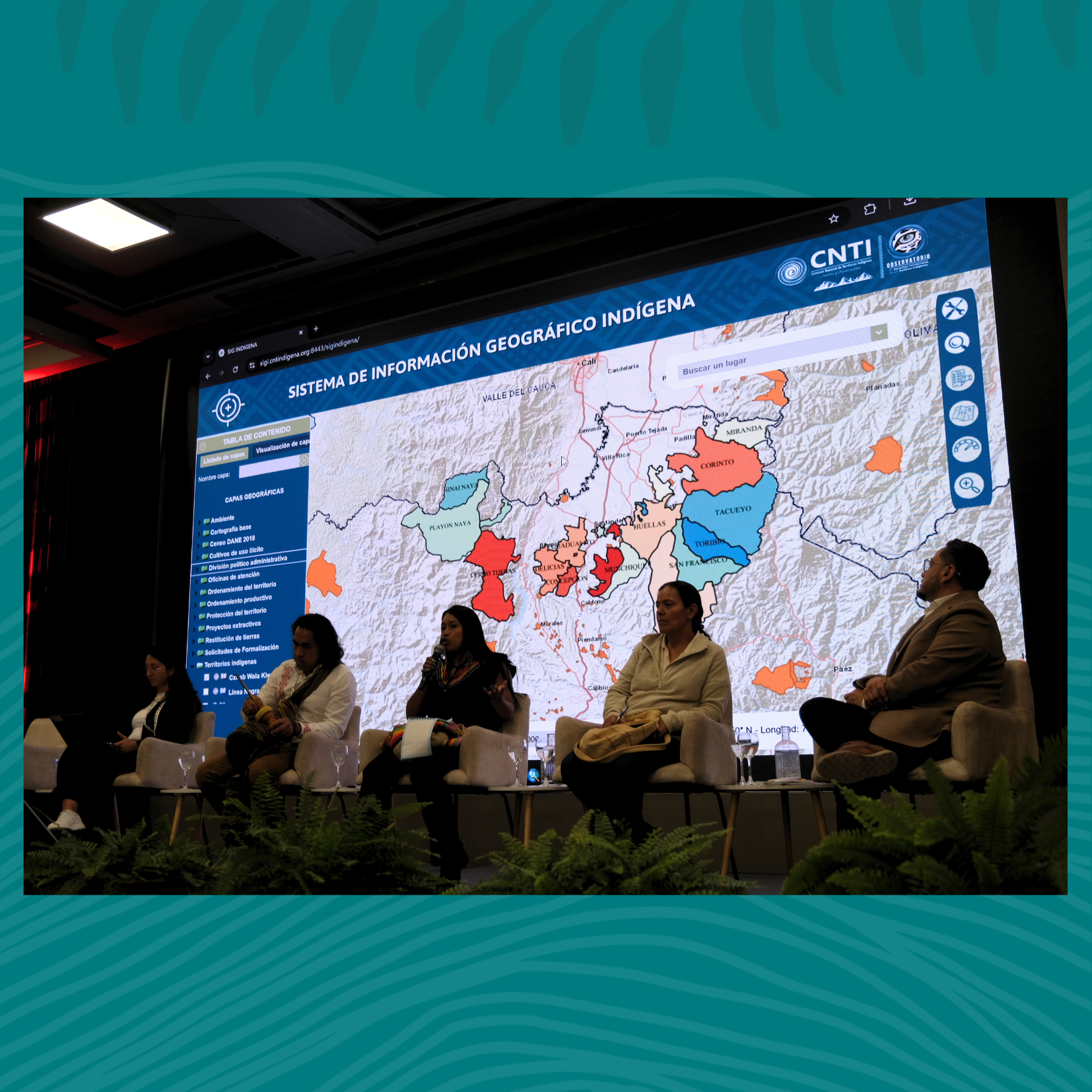
Presentation of the SIG Indígena in Bogotá
Building on this momentum, Indigenous organisations across the Amazon Basin are coming together to strengthen territorial mapping and monitoring efforts regionally.
Tenure Facility partners at the September learning exchange agreed to launch the Geographic Information System Coordination Network, a regional network designed to connect organisations across the Amazon Basin. It will enable continuous sharing of experiences, tools, and strategies while reinforcing collective capacities for territorial defence.
At the same time, some organisations are working on a roadmap to engage with national governments to strengthen Indigenous information systems and continue their generations-old mission: protecting the Amazon rainforest.
With every map drawn, every threat identified, and every alliance forged, Indigenous organisations are strengthening their skills to defend the rainforest. In doing so, they are protecting not only their homes but also one of the last great lifelines of our planet.
Articles